During the four and a half years of my residency in Germany, I had the opportunity to visit a number of countries in Europe. Along with these visits, I also had the opportunity to wander the surrounding regions on a bicycle. Dedicated routes for bicycling with visible lane markings, proper directions and above all the respect proffered by motorists on the roads to cyclists make cycling in Germany a pleasant experience. Besides, the provision to carry your bicycle on the train, bus or tram gives you the option of hopping onto one these modes whenever you feel too tired or exhausted to cycle. Because of such a favorable and conducive environment, a bicycle is a popular mode of transport in Germany. I too purchased a strong and rugged mountain bike. Along with the bike I purchased a helmet, a speedometer, a bicycle lamp and many such accessories and started wandering around on the bicycle in my spare time. To begin with, I started wandering nearby places, then moved on to scenic places located within a radius of 30 kilometers and then steadily went on increasing the radius.
After gaining a semblance of confidence in my cycling ability, I started planning long-distance rides. I had heard a lot about the middle Rhine valley (mittlerhinetal in German). The Rhine is the second longest river in central and western Europe. Originating in the Alps in south-eastern Switzerland, the river flows into lake Constance (Bodensee) located between Germany, Switzerland and Austria. From the lake, the river rises once more near the city of Constance. At its source near the lake, the river flows westwards towards the city of Basel and then turns north, flows along the Franco-German border before finally entering Germany near the city of Karlsruhe. The Rhine basin in Germany is very fertile and has a relatively warm weather due to which it has a high population density. Finally, near the city of Rotterdam in Holland, the river merges with the North Sea. The Rhine is the lifeline of western Europe.
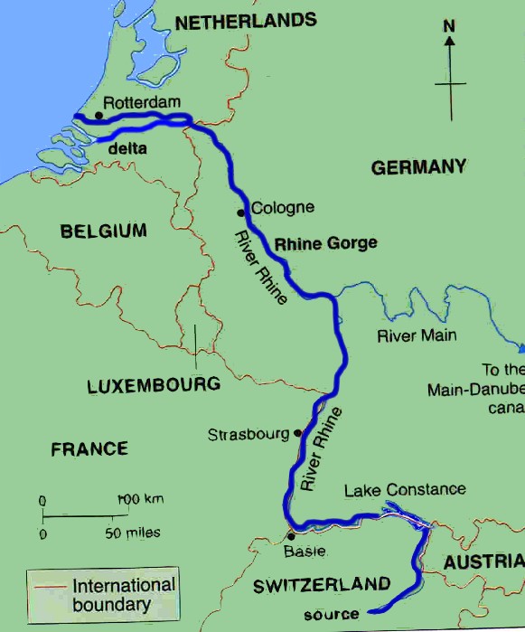 |
| The map of Rhine (source – internet) |
During the first century AD, the Rhine constituted the northern and eastern boundaries of the Roman empire. Along the banks of the river there were frequent skirmishes between the Roman and German troops. Hence, a constant live vigil was maintained along the river. The river was also an important waterway joining the northern and southern regions of Europe. After the first World War, as a part of the Treaty of Versailles, the fertile basin around Rhine was taken away from Germany. Along with other humiliating conditions, this clause too contributed to a feeling of discontent in the hearts of the German people. The manner in which history unfolded later is known to all. The Rhine stands in testimony, a silent witness to such important historical events.
The central Rhine valley is perhaps the most enchanting region along the entire river stream. Near the city of Bingen in Germany the Rhine enters a valley. Hereon, up to Koblenz (about 65 kilometers downstream), the river flows through the valley. Eons of erosion have created characteristic landscapes in the valley. At times sheer cliffs hewn in and at other times gentle slopes line the banks of the river. To keep an eye on the traffic along the river, many castles were built on the hilltops along the river banks. The central valley has 40 such castles. Due to the warm weather, the land in the valley is suitable for the cultivation of grapes. Hence, the slopes of the mountains along the route are dotted with vineyards. The wine from the valley too, is well-known. As a result of such natural and cultural features, the valley has been declared a World Heritage Site.
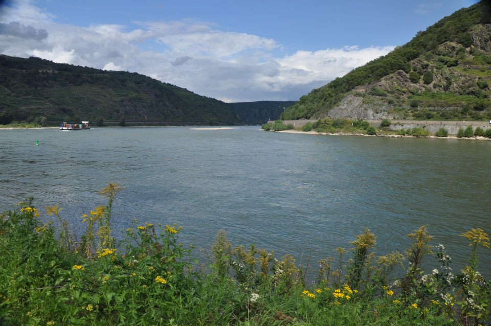 |
| The middle Rhine valley |